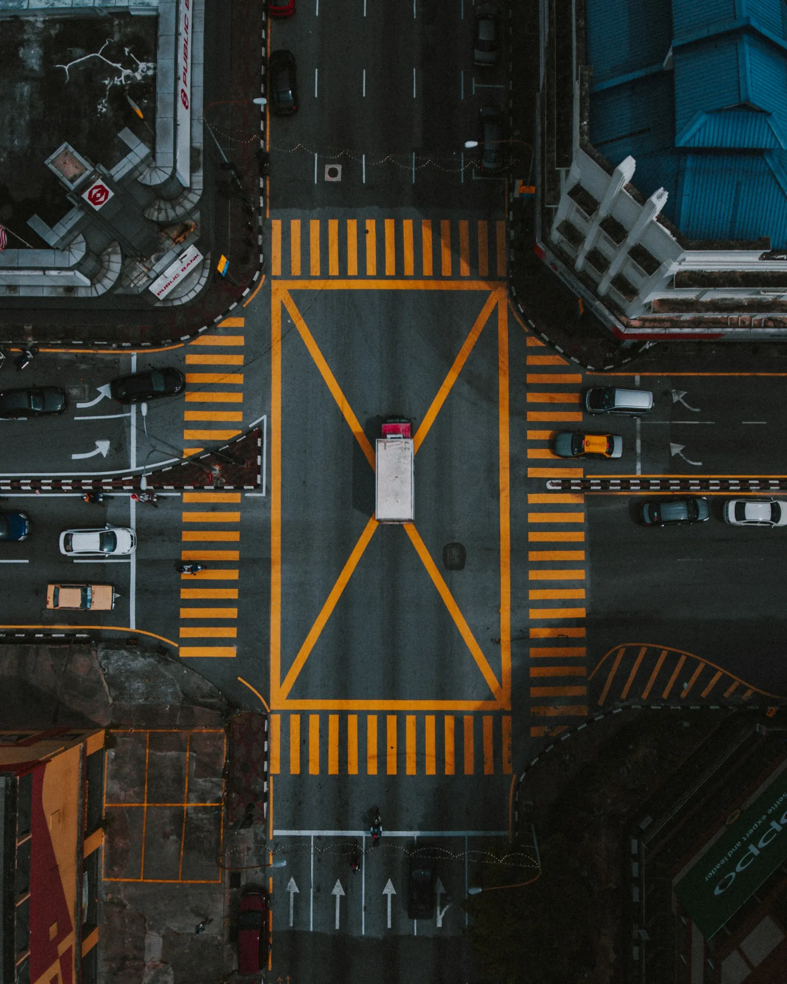
Drone traffic monitoring means hovering a camera drone above a road, junction or car park and recording video, from which software extracts every vehicle's path, speed and lane changes. It produces far more detail than a traffic counter. The highD project recorded more than 110,000 vehicles on German motorways with a positioning error typically under 10 cm, and the pNEUMA experiment used 10 drones over central Athens to capture close to half a million trajectories. Drones are also used at crash scenes, where the Washington State Patrol reported an 80% cut in road closure time. In Helsinki, Flyby Guys has flown multi-day traffic data collection with six pilots for mobility analytics company MobiLysis.
This guide explains how drone traffic monitoring works, what it is used for, where it falls short, the rules in Europe and how a survey is planned.
Table of contents
How drone traffic monitoring works
The drone hovers at a fixed point. For most studies it holds position high above the site with the camera pointing straight down, so the whole junction or road section is in one frame.
It records high-resolution video. A top-down view avoids the blind spots that roadside cameras have when large vehicles block smaller ones.
Software tracks every road user. Computer vision detects each vehicle, cyclist or pedestrian in every frame and joins the detections into trajectories.
The trajectories become traffic data. From them you can calculate counts, turning movements, speeds, gaps between vehicles, queue lengths, lane changes and near misses.
Battery life sets the length of each flight, so longer studies use several drones in relay or a tethered drone powered from the ground.
Drones compared with other traffic data
| Method | What it measures | Strengths | Limits |
|---|---|---|---|
| Loop detectors and radar | Counts and speeds at one point | Run continuously for years | No paths, turning movements or behaviour between sensors |
| Fixed roadside cameras | Counts and some movements | Permanent, work at night with lighting | Low viewing angle, vehicles hide each other |
| GPS and connected vehicle data | Journey times over a network | Wide coverage | Only a sample of vehicles, little detail at a junction |
| Drones | Full trajectories of every road user in view | Very detailed, quick to deploy, no roadside installation | Short sessions, weather and daylight limits, airspace rules |
Drones work best alongside permanent sensors: the sensors show how traffic changes over months, and the drone shows exactly why a junction or merge point behaves the way it does.
What drones are used for in traffic management
Motorways and highways
Drone footage of motorway sections shows lane changes, merging, gaps and speed differences in detail. The highD dataset from RWTH Aachen recorded traffic at six locations on German motorways and is widely used to test automated driving systems.
Urban junctions and corridors
In cities, drones can see every road user at once. The pNEUMA experiment flew 10 drones over 1.3 km² of central Athens, covering around 100 busy intersections. Helsinki has also used drones and AI to track cars, trams, bicycles, e-scooters and pedestrians, with the aim of modelling how congestion forms.
Crash scenes and incidents
A drone can map a crash scene in a 10 to 15 minute flight, against up to two hours with a total station, according to the US Federal Highway Administration. In a 2018 pilot, the Washington State Patrol reported an 80% reduction in road closure time and estimated economic savings of about $4.2 million. For airborne support in emergencies, see our guide to drones for search and rescue.
Events and crowds
Before and after concerts, matches and festivals, a drone shows how traffic, parking and pedestrian flows interact, so organisers can adjust routes and staffing. Read more in our guide to drones for crowd control.
Roadworks and bridges
Drone surveys show how traffic behaves around lane closures and on bridges, and can be repeated as the works move. Our guide to drones in construction covers site monitoring more broadly.
Parking
One flight over a car park or street gives an occupancy count at a single moment, and repeated flights show how demand changes through the day.
Ports and logistics hubs
At ports, terminals and distribution centres, drones show truck queues, gate delays and yard layouts that are hard to see from the ground.
Case study: traffic data collection in Helsinki
For a large traffic management project in Helsinki, Swiss smart mobility company MobiLysis needed precise aerial data across several days. Flyby Guys ran the operation at one key location with six drone pilots over three consecutive days, covering mission planning, permit applications to air traffic control and local authorities, on-site coordination and delivery of the data for analysis. Find out more about our drone traffic analysis service for cities.
Multi-day surveys like this depend as much on planning and permits as on flying: every pilot, position and time slot has to be agreed in advance, and the recording must run without gaps. MobiLysis CEO Manos Barmpounakis said the collaboration “has set a high standard for future operations.” Read the full MobiLysis case study.
Limitations
Short sessions. Each battery lasts tens of minutes, so all-day studies need relays or a tethered system.
Weather and light. Rain, strong wind and fog stop flights, and video analysis is harder at night. See our guide to drone weather limits.
Privacy. Video that shows identifiable people or number plates can be personal data under GDPR. Fly high enough for the task, store footage securely and deliver anonymised trajectories where possible.
Airspace. Sites near airports, hospitals and other restricted zones may need permission or be ruled out. Our no-fly zone guide explains how to check.
Not a permanent sensor. Drones give detailed snapshots, not continuous monitoring year round.
Rules in Europe and Finland
Traffic monitoring usually means flying over or near roads with uninvolved people around, often in towns. In the EU open category, drones must not fly over assemblies of people, and heavier drones in subcategory A3 must stay 150 m from residential, commercial, industrial and recreational areas. That rules out most urban traffic surveys in the open category, so professional traffic work is normally flown in the specific category, with an operational authorisation from the national aviation authority based on a SORA risk assessment.
In Finland, the authority is Traficom. Before each flight, Flyby Guys checks restricted zones and announces its flights in Fintraffic Sky, the national drone traffic service, which also shows other air traffic such as rescue helicopters. Our CEO Stephen Sutton has described operations where the same routes are flown once or twice a week, which is typical of repeat traffic surveys. For the wider framework, see our guide to EASA drone regulations.
How a drone traffic survey is planned
Define the question. Turning counts at one junction, merging behaviour on a slip road and parking occupancy across a district need different flights.
Choose sites and heights. The drone must cover the whole area of interest in one frame, or several drones must cover it together.
Get permissions. Check airspace, apply for any authorisation needed, and agree access with the road authority and landowners.
Schedule the flights. Cover the periods that matter, usually morning and evening peaks, and keep backup dates for bad weather.
Fly in relays. Swap drones or batteries so there are no gaps in the recording.
Process and check the data. Extract trajectories, then check them against manual counts or permanent sensors.
Deliver usable results. Counts, speeds, queue lengths and conflict maps in the format your traffic models use.
Frequently asked questions
How do drones monitor traffic?
A drone hovers above a road or junction and records top-down video. Software then tracks every vehicle, cyclist and pedestrian to produce counts, speeds, turning movements and trajectories.
How accurate is drone traffic data?
Very accurate for position and movement. The highD project reported a positioning error typically under 10 cm. Accuracy depends on flight height, camera, stability and the tracking software.
How long can a drone monitor traffic?
One battery gives tens of minutes. Longer studies use relays of drones or a tethered drone powered from the ground.
Can drones help clear crash scenes faster?
Yes. The US Federal Highway Administration reports that a drone can map a scene in 10 to 15 minutes, and the Washington State Patrol reported an 80% cut in road closure time in a 2018 pilot.
Do you need permission to fly a drone over traffic?
Usually, yes. In the EU, most traffic monitoring over roads near people falls into the specific category and needs an operational authorisation. Always check airspace restrictions first.


